dēzl OTR820 is an 8” GPS navigator for professional truck drivers with custom routing, road warnings, satellite imagery of destinations, dēzl community insights, mount in portrait or landscape view.
General
|
| Dimension |
7.87″ W x 4.92″ H x 0.79″ D (20.0 x 12.5 x 2.0 cm) |
| Weight |
14.3 oz (405 g)
|
| Display Type |
8″ wide view IPS, color TFT, with on-cell capacitive touch panel |
| Display Size |
6.8″ W x 4.2″ H (17.2 x 10.7 cm); 8″ (20.3 cm) diagonal |
| Display resolution |
1280 x 800 pixels |
| Dual-orientation display |
|
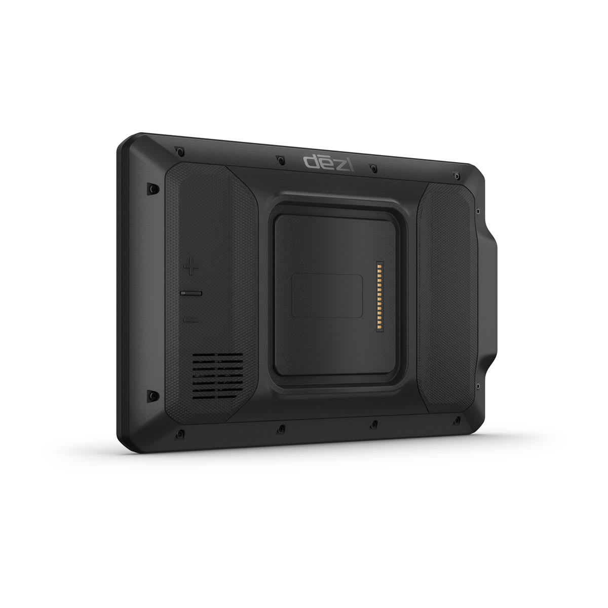
| Magnetic Mount |
|
| 1″ ball adapter with AMPS plate |
|
| Battery Type |
rechargeable lithium-ion |
| Battery life |
up to 2 hours
|
Maps & Memory
|
| Data cards |
microSD™ card (not included) |
| Preloaded street maps |
|
| 3D Terrain |
|
| Internal storage |
32 GB |
| Ability to add maps |
|
| External memory storage |
microSD™ card (not included) |
| Includes map updates |
|
| Downloadable Satellite Imagery |
|
| BirdsEye Direct Satellite Imagery |
|
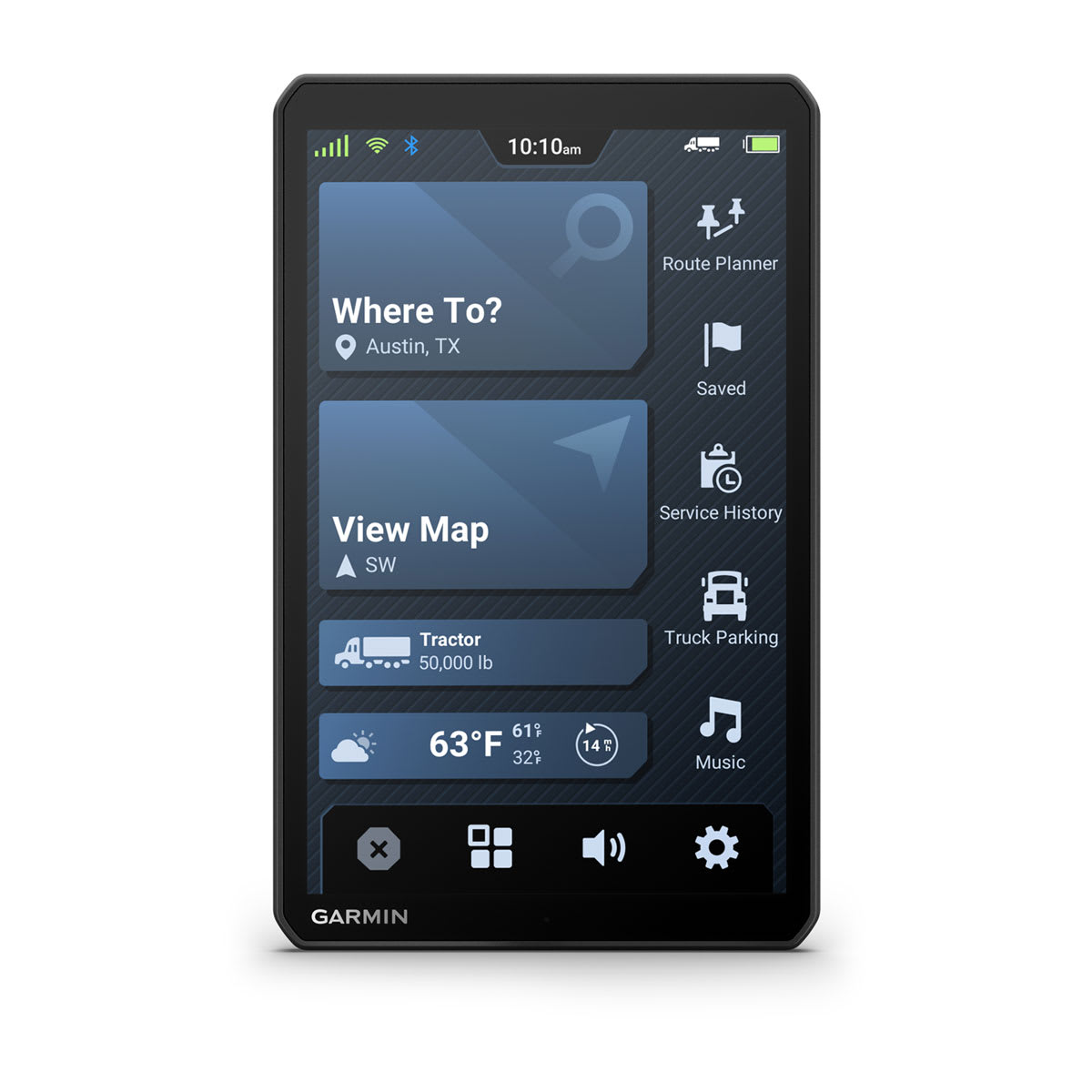
Trucking Smartwatch Features
|
| Easy break planning |
|
| Truck plaza loyalty programs |
|
Camera Features
|
| Backup camera compatible |
|
Navigation Features
|
| Garmin Real Directions™ landmark guidance |
|
| Millions of Foursquare® points of interest |
|
| TripAdvisor® Traveler Ratings |
|
| Route shaping through preferred cities/streets |
|
| Voice-activated navigation (operate device with spoken commands) |
|
| Includes traffic |
|
| Lane assist with junction view (displays junction signs) |
|
| Bluetooth® pairing |
|
| Speed limit indicator (displays speed limit for most major roads in the U.S. and Europe) |
|
| Driver alerts for sharp curves, school zones, red light and speed camera warnings and more |
|
Advanced Features
|
| Smart notifications via app |
|
| Wi-Fi® map and software updates |
|
| Access to live services via app (traffic, weather, etc.) |
|
Connectivity
|
| Smartphone platform compatibility |
iPhone®, Android™
|
| Works with Garmin app on a compatible smartphone |
yes (via the Garmin dēzl™ app) |
| Requires Bluetooth®-enabled smartphone |
yes
|
Semi Truck Features
|
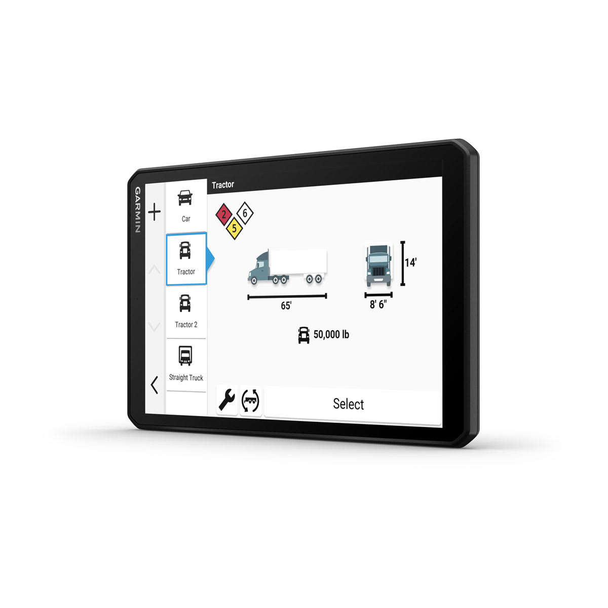
| Specialized truck routing |
|
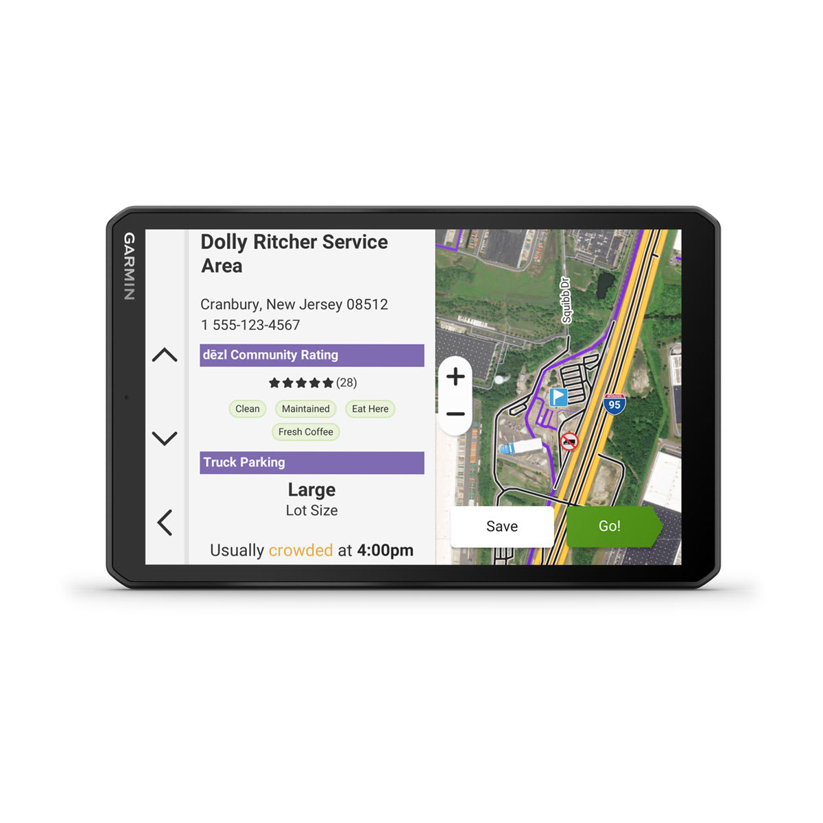
| Rated community truck parking |
|
| Community truck destinations |
|
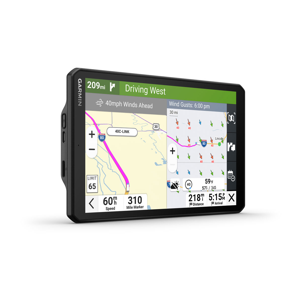
| Wind speed weather overlay |
|
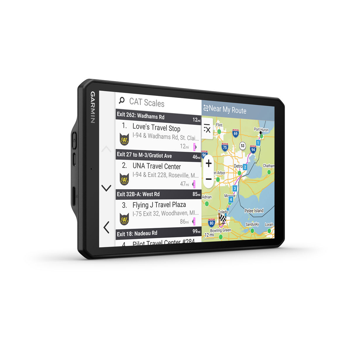
| CAT scale locator |
|
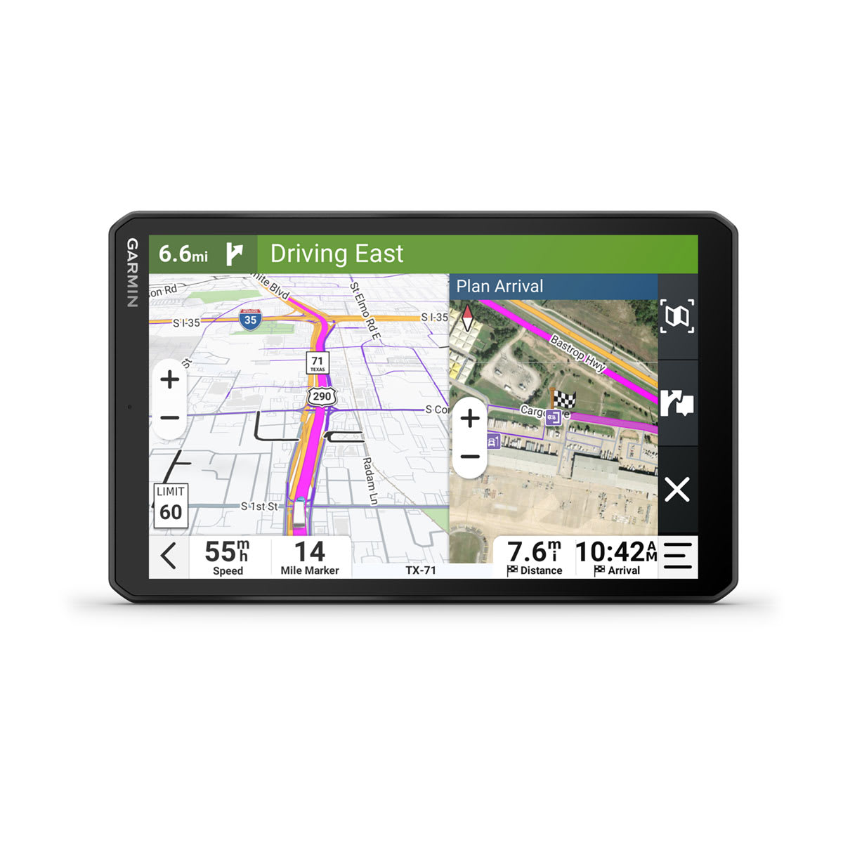
| Expert arrival planning with BirdsEye Direct Satellite Imagery |
|
| Route overview split screen view |
|
| Live shower and parking data |
|
| PrePass weigh station notifications and bypass decisions |
|
| Trucking points of interest |
|
| Truck-specific speed limits |
|
| Truck & Trailer Services directory |
|
| Sunrise/sunset times – Trucking |
|
| State & country border notices – Trucking |
|
| Simple truck profile |
|
| Popular truck route data |
|
| Mile marker info – Trucking |
|
| Load-to-dock guidance |
|
| IFTA fuel logging capability |
|
| HOS violation warnings |
|